ALEAD: Artificial Learning Environments for Autonomous Driving
CGA Simulation has created ALEAD, a system designed to teach autonomous vehicles to drive in a safe, virtual environment. It saves time and money for companies developing autonomous driving technologies; the simulated environment is created using Unity 3D graphics, with Baidu Apollo open driving solution, and Robot Operating System (ROS). ALEAD will provide various locations comprising of HD roads and assets, that pose hyper-realistic scenarios for autonomous vehicles. All environments and assets created are compatible with LG Sim and other open-source driving simulators.
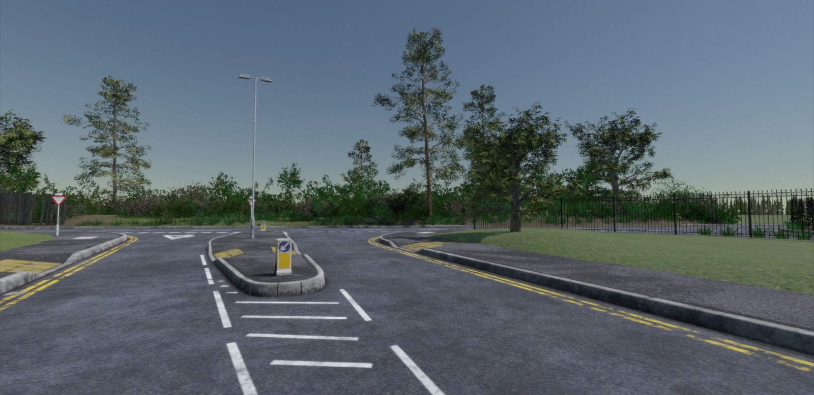
HD Environments
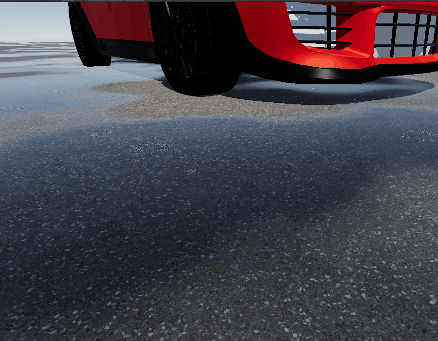
The bonus for autonomous vehicle developers is that simulated environments can replace live trials in initial product development and testing. ALEAD allows autonomous vehicles to navigate complex junctions featuring realistic road markings and street furniture. ALEAD operates a million times faster than running live trials and can replicate extreme events and environmental conditions like fog, debris in the road and unpredictable (non-autonomous) vehicles. Its physically realistic sensor models and environmental factors, create a more realistic teaching environment.
HD Maps
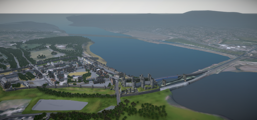
Environment Data in HD map format is necessary for autonomous vehicle functionality. We have used a variety of different mapping technologies to get as accurate a representation of the world as possible in order to create HD large-scale maps for various locations. Our expertise in this field has gone on to help Project Synergy successfully trial their new V2X (vehicle to everything) Signal Phase and Timing (SPaT) software module and roadside unit (RSU) at the A555 Manchester Airport Relief Road / Styal Road intersection in South Manchester.
Project Synergy was established in 2019 to test autonomous vehicles on roads in the Greater Manchester area. The project aims to innovate autonomous cars and the use of autonomous pods in an airside setting at Manchester Airport and advances in connected and autonomous vehicles.
Weather
Accurate Sensor Models
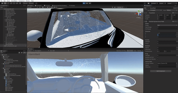
The ALEAD system uses representative sensor models for key sensors that are likely to be present in future autonomous vehicles, including short-range Radar, IR/TV cameras, Lidar scanners, and GPS/ satellite navigation systems. The aim is to identify factors that determine or limit sensor performance and therefore could have an adverse effect on the safety of autonomous vehicles, like high humidity, fog, bright light (the sun being low in the sky and building reflections), erratic behaviour from other road users, deteriorated street signs or markings and deliberate jamming of sensor data. The sensor modelling makes the training physically realistic for computer vision, which is different from human perception, we can also create environmental models to represent the effect of active sources on the sensor models including thermal illumination, light sources and radio emissions.
In-Game Editor System and Autonomous Driving Test
Each autonomous vehicle will take a simulated driving test before taking to the road, to make sure it is truly safe and road-worthy. We have created HD environments suitable for a virtual driving test modelled around a ‘Sim City’- style simulated world. These HD environments will pose various realistic hazards for autonomous vehicles.
CGA has developed a simulator that integrates a complex 3D model of urban environments that accurately depicts Conwy and the San Jose area with accurate vehicle traffic flow, peoples’ actions, and other spatial data. Our high-resolution Artificial Intelligence vehicles feature varying driver behaviours, AI cars indicating, and realistic traffic flow.
We have an integrated Editor System to allow different scenarios and tests to be created easily. This In-Game Editor allows end-users to set up their own CCAV and general driving challenges, allowing bespoke driving tests to be created and shared.
Features
- Scenario Editor – Contains information about the scenario (Driving Route, Hazards on Route, written details)
- Hazard Editor – Contains information about the vehicle type, name, route and behaviour of the hazard, as well as what starts/actives the hazard (trigger)
- Route Editor & Visualiser – Define the roads used and the directions to drive down them to construct a route
- Conversation Editor – Create dialogue to be displayed to the user on certain events (looking left/right, stopping, driving through a trigger etc)
- Trigger Editor – A box/volume which is triggered when driven through, these are defined by the road they are on and how far down the road they are, as well as what vehicle trigger them (Hazard or Player/User vehicle)
- Ability to change variables to the in-game editor i.e. pedestrians, weather.